
Quotation


Performance
4D Technology Seminar Simultaneous Interpretation | Geospatial Intelligence · Digital Twin Simulation · Time-Based Spatial Analytics – UNIVERSE RB
- 2025.12.08
This international 4D geospatial conference explores advanced geospatial technologies, digital twins, smart city innovation, autonomous mobility, and spatial data governance for the next generation of intelligent infrastructure.
Key interpretation topics include high-precision GIS, LiDAR-, satellite-, and drone-based 3D data acquisition, time-based terrain change analysis, urban digital twin modeling, 4D BIM, disaster response simulation, UAV route optimization, autonomous navigation, Air Traffic Flow Management (ATFM), OGC geospatial standards, and national geospatial information policies.
Because the geospatial industry integrates GIS, remote sensing, digital twins, BIM, artificial intelligence, autonomous mobility, and urban planning, professional interpretation is essential to accurately communicate technical concepts, data standards, industrial applications, and public policy initiatives.
Emerging Technologies & Convergence
Category Description
This category covers interpretation cases related to emerging technologies and
digital convergence, including blockchain, Web3, fintech, XR, and AI-integrated
technologies.
UNIVERSE RB provides integrated services including:
Simultaneous interpretation Consecutive interpretation Technology conference interpretation Technical document translation QMS-based quality management operations
We support blockchain forums, Web3 seminars, and digital technology conferences with professional interpretation environments.
Inserted Text for Articles
Executive Summary
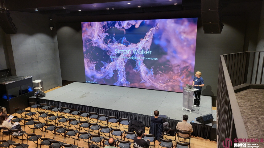
The 4D Technology Seminar was a high-level interdisciplinary forum dedicated to time-integrated spatial simulation technologies across urban planning, aviation, mobility, construction, disaster response, robotics, and national geospatial policy.
The seminar required simultaneous interpretation across advanced domains including GIS, Lidar-based 3D acquisition, Digital Twin modeling, 4D BIM, AI-powered simulation analytics, and international standardization frameworks.
UNIVERSE RB delivered structured interpretation ensuring technical precision, conceptual clarity, and synchronized delivery aligned with dynamic visual simulations.
1. Overview
The 4D Technology Seminar explored how spatial data integrated with time transforms industrial and policy decision-making.
Participants included:
-
Geospatial and GIS specialists
-
Aviation and mobility researchers
-
Engineering and construction firms
-
Digital Twin solution providers
-
Public-sector land and urban authorities
-
Research institutions and standardization experts
Interpretation required precise linkage between technical modeling concepts, software interfaces, and policy frameworks.
2. Key Topics
1 4D Geospatial Technologies
-
High-precision Geographic Information Systems
-
Lidar-based point cloud acquisition
-
Satellite and UAV terrain mapping
-
Time-series terrain deformation analysis
Terminology such as point cloud density, mesh reconstruction, and Level of Detail LOD required consistent and accurate rendering.
2 Digital Twins and Urban Simulation
-
Integrated traffic and infrastructure modeling
-
Energy grid optimization
-
4D flood and wildfire simulation
-
Earthquake impact time progression models
-
4D BIM for lifecycle construction management
Interpretation required alignment of spoken explanations with moving simulation timelines and layered data visualization.
3 Aviation, Mobility, and Robotics
-
4D flight-path optimization for UAV systems
-
Autonomous navigation algorithms
-
Air Traffic Flow Management prediction models
-
Geofencing systems
Precision was essential in describing predictive modeling parameters and aviation safety terminology.
4 Industry, Policy, and International Standards
-
OGC geospatial data standards
-
National land information frameworks
-
Urban and environmental monitoring strategies
-
Cross-border data interoperability
Policy sessions required formal structured tone and consistency in regulatory vocabulary.
3. Interpretation Format
-
Keynote sessions: Simultaneous interpretation
-
Technical sessions: Simultaneous interpretation
-
Software demonstrations: On-site interpretation
-
Panel discussions: Hybrid simultaneous and consecutive
-
Workshops: On-site interpretation
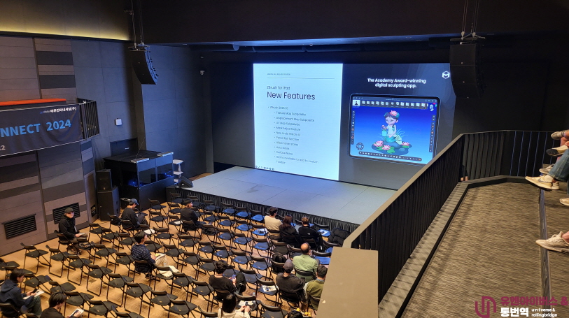
Demonstration sessions required real-time synchronization with live software environments and animated modeling systems.
4. Required Competencies
1 Deep understanding of GIS, 3D modeling, Digital Twin systems, and BIM integration
2 Familiarity with terminology including
-
Point cloud
-
Mesh reconstruction
-
Geofencing
-
4D BIM
-
LOD
-
Spatial interpolation
3 Ability to process complex data visualizations and numerical simulations
4 Tone adaptability between analytical technical discourse and policy frameworks
5 Rapid interpretation during dynamic screen-based demonstrations
5. Representative Interpretation Scenarios
Case 1 Digital Twin Urban Simulation Summit
Simultaneous interpretation for time-based infrastructure simulation sessions.
Handled
-
Multi-layered modeling explanation
-
Traffic congestion prediction analytics
-
Infrastructure load simulation metrics
-
Outcome
Enhanced interdisciplinary comprehension among planners and engineers.
Case 2 National Geospatial Strategy Forum
Interpreted high-level presentations on Lidar acquisition standards and national geospatial policy frameworks.
Maintained formal policy tone and technical precision.
Outcome
Supported cross-agency strategic alignment.
Case 3 Aviation 4D Modeling Symposium
Interpreted predictive air traffic flow management modeling discussions.
Ensured accuracy in altitude, velocity, and time-sequence forecasting terminology.
Outcome
Clear technical understanding among aviation specialists.

6. Interpretation Notes
Technical Terminology Precision
4D BIM must reflect integration of 3D model and project schedule timeline.
Point cloud refers specifically to spatial coordinate datasets, not generic 3D imagery.
Digital Twin must denote a synchronized virtual replica linked to real-time data.
Visual-Heavy Presentation Handling
4D simulations involve
-
Time-lapse terrain shifts
-
Animated infrastructure models
-
Moving UAV trajectories
-
Data overlays
Interpretation flow should follow
Visual transition → System function → Analytical implication
Tone Calibration
Technical sessions require analytical clarity and structured phrasing.
Policy sessions require formal and regulatory-consistent language.
Predictive Model Sensitivity
Small numerical differences in
-
Flood depth
-
Wind velocity
-
Structural load
-
Simulation time
can significantly alter interpretation.
Numerical precision is critical.
7. FAQ
Q1 Why is 4D technology interpretation considered advanced
Because it integrates geospatial modeling, engineering systems, AI analytics, and regulatory frameworks simultaneously.
Q2 Are dual interpreters recommended
Yes. Extended technical seminars with dense modeling content require dual simultaneous teams.
Q3 How are live software demonstrations handled
Through close coordination with presenters and pre-session terminology preparation.
Q4 Is pre-event glossary alignment essential
Absolutely. Specialized geospatial and simulation vocabulary must be standardized in advance.
8. Pricing Determination Conditions
Interpretation fees are determined by
1 Number of interpretation languages and booths
2 Density of advanced geospatial and simulation terminology
3 Volume of live software demonstrations
4 Hybrid broadcasting and technical integration requirements
5 Participation of national policy authorities
6 Pre-event documentation and glossary development
7 Duration of multi-session workshops
4D Technology Seminars are categorized as highly technical industry-policy convergence events requiring senior interpreters with geospatial and engineering domain expertise.
Conclusion
Simultaneous interpretation for a 4D Technology Seminar represents one of the most advanced technical interpretation domains, integrating geospatial systems, Digital Twin modeling, aviation prediction, construction lifecycle management, and national policy frameworks.
It demands
-
Deep technical comprehension
-
Strong visual processing capability
-
Numerical precision
-
Structured policy awareness
Through disciplined preparation and interdisciplinary expertise, UNIVERSE RB ensured accurate and coherent communication supporting innovation in 4D simulation technologies and smart infrastructure systems worldwide.
This
case represents one of the seminars or forums discussing the industrial
application of emerging technologies.
Technologies such as blockchain, digital finance, XR, and AI continue to
converge across industries and shape new digital ecosystems.
→ View Emerging Technologies & Convergence Cases
https://universerb.com/en/11_en/45?page=41

About Our Case Archive
The case studies and project insights presented on this website are based on experience supporting international conferences, investor presentations, government forums, executive meetings, technical seminars, and multilingual corporate events.
To protect client confidentiality and comply with the Code of Professional Conduct followed by professional interpreters worldwide, certain project details have been generalized, anonymized, or adapted for educational purposes.
The purpose of these materials is to share practical insights into multilingual communication planning while respecting the confidentiality of every client and every project.
UNIVERSE RB
Designing Communication. Managing Risk. Delivering Understanding.